Biodiversity Audits Explained
The Whole Farm Plan (WFP) biodiversity audit requires farmers and crofters to identify the biodiversity on their farm or croft by creating a habitat map of all the land that they manage on a permanent basis, identifying specific habitats e.g. cropped land, wetland and woodland and linear features that are present on their farms and crofts. Many farmers and crofters have prioritised completion of carbon audits as part of the WFP requirements as grant funding was available under Preparing for Sustainable Farming (PSF) for this, however by 15 May 2028, all farmers and crofters are required to have a biodiversity audit completed.
What is a Biodiversity Audit?
The biodiversity audit is one of the five elements of the WFP as a condition for the receipt of Basic Payment Scheme (BPS) subsidy. It is one of two WFP elements (the other being the carbon audit) that all farmers with permanent land will have to have in place by 2028. The other three elements; animal health and welfare plan, soil analysis and integrated pest management plan will depend on the farming system.
Those who haven’t yet completed a biodiversity audit will need to complete one in time for the 2028 BPS claim deadline.
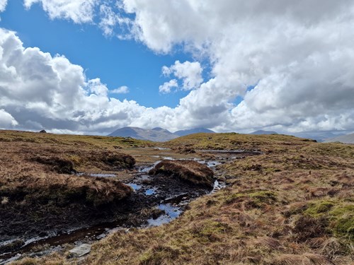
The biodiversity audit is essentially a map of habitats on the farm, using a standardised list of habitats grouped into broad categories such as woodlands, grasslands, cropped land, upland and peatlands, which are then split into more specific categories such as natural woodland, conifer plantation, improved grassland and unimproved grassland. Linear features such as drystone dykes, hedges and rivers and streams are also mapped. There is information to help identify these habitats on the Farm Advisory Service website, including a series of videos. If you have an Agri-Environment Climate Scheme (AECS) application from 2024 or earlier, the farm environmental assessment map will contain some, but not all, of the information required. From 2025 onwards, the AECS farm environmental assessment and the biodiversity audit map are the same thing.

As a minimum, farmers and crofters must:
- Create a habitat map which covers all land managed on a permanent basis.
- Allocate at least one habitat category which best describes most of the land cover for each land parcel/field, using the Whole Farm Plan habitat and feature key as detailed below.
- Include any linear features such as hedges, line of trees, drystone dykes and rivers and streams (that are not visible on ordnance survey mapping).
For an intensively managed farm where most fields are improved grassland or arable, the map can therefore be quite simple. More detail can be added by splitting land parcels into different habitats where this occurs. Though not mandatory, this is encouraged as it will highlight small areas of natural habitat that could be important refuges for biodiversity in otherwise intensively managed fields. It is particularly useful if the biodiversity audit is going to be used to support an AECS application.
How to Complete the Biodiversity Audit
There are several ways in which the biodiversity audit can be prepared. At a very simple level, a list of fields can be marked with the dominant habitat in each field and submitted to the Rural Payments land mapping team. This option is only appropriate if there are no linear or boundary features to map. In other situations, a map will have to be drawn. This can be done manually by hand colouring a map according to the habitat key, digitally using mapping software, or online using the Rural Payments mapping system. There is also a Farm Biodiversity Scotland app developed by NatureScot that can be used to prepare the map. While farmers and crofters are encouraged to prepare their own biodiversity audits, it is possible to use a consultant to help prepare them if necessary.
Whatever method is used to prepare the map, it is important to note that this is the only element of the Whole Farm Plan that must be submitted along with the Single Application Form (all the other elements simply need to be available for inspection). If the biodiversity audit has not been created using the Rural Payments online mapping system, the map must be sent to the RPID Land Mapping Team. Once submitted, the audit is valid for five years, after which it must be reviewed and updated if required. It is also possible to update it at shorter intervals.
Unfortunately, there is no specific funding to support the preparation of biodiversity audits. However, the funding for Farm Advisory Specialist Advice Plans (currently temporarily suspended) can be used to get assistance with preparing the audit, alongside recommendations for habitat management. This may be worthwhile for those with a particular interest in managing biodiversity on their farm but is not recommended for those with simple farm habitats just seeking to meet the regulatory requirements of the biodiversity audit.
Five Top Tips
- You will need to have a biodiversity audit map in place by 15 May 2028.
- As a minimum, allocate at least one habitat category which best describes the main habitat present and include any linear features such as hedges.
- Use one of the five ways to complete the biodiversity audit as listed on the Rural Payments website.
- The Biodiversity Map must be reviewed and updated at least once every five years. However, it is recommended that it is updated as required to reflect any changes within that period.
- For further information on completing your biodiversity audit map, please visit the biodiversity audit habitat identification help sheet on the FAS website.
Paul Chapman, Senior Conservation Consultant, Paul.Chapman@sac.co.uk
Posted by SAC Consulting on 19/02/2026